Sunday, 30 August 2020

Fotheringhay


Summary

This walk has sections across open fields, alongside waterways, through woodlands and on public roads. Throw in a good dose of history and you've just about got it all!

Statistics

Start: The Red Lion at Warmington PE8 6TN

Map: OS Explorer OL227: Peterborough

Parking: Road opposite The Red Lion

Distance: 10.8km (about 6.7 miles)

Refreshments:The Falcon at Fotheringhay or The Red Lion

The Walk

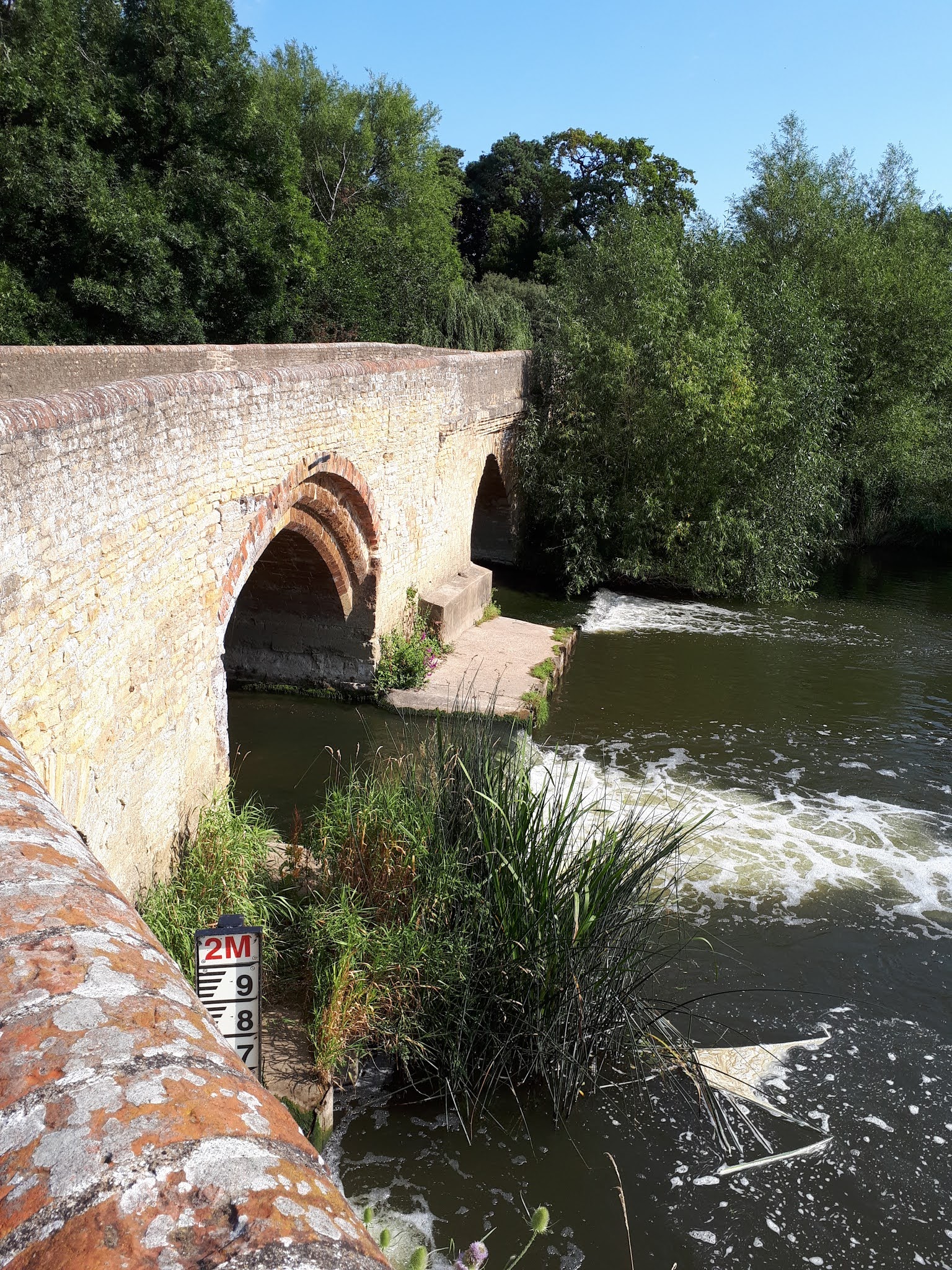
The Red Lion is actually in a hamlet called Eaglethope, just on the outskirt of Warmington. As you look at the pub there is a footpath to the left next to a new house. Walk down here and slightly left across the field towards some trees. Pass between the houses and the trees, through a gate and onto a small road. Turn left down the track which passes under the A605 bringing you out with an old water mill in front of you. Turn right before the mill and then left beside the river.The footpath heads off to the right and you need to walk diagonally across the field to a footbridge that may or may not cross water, depending on the time of year!. Once over the bridge head over the next field towards the lock in the river. After crossing this, bear left and head straight over the field until you reach a track. Take this track and head straight on; you can see Fotheringhay church in front of you. After a while you'll pass some barns on your left and then you'll see a grassy mound which is all that remains of Fotheringhay Castle. Spend a bit of time walking to the top of the mound where there are excellent views all around. This a good place to sit and have your sandwiches!

Get back on the track and head into the village of Fotheringhay. Pass the church on your left and Fotheringhay Road to your right (you could walk up here and rejoin the walk to cut about a kilometre off the walk). Continue past The Falcon on your left and take the footpath that is signposted on your right. The path crosses a field to a footbridge over the brook. Turn left after crossing the bridge and walk keeping the brook on your left until you get to a track. Turn right and walk about 400 metres where there will be a footpath to your right. Take this, passing some trees to you left and then past a farm house. The path brings you out on Fotheringhay Road. Take a right and the a quick left onto the signed footpath. 

This track is pretty straight for about 1.5km until you reach the River Nene. Cross the river using the bridge and the track leads into the village of Elton. The road bends into Middle Street but you need Chapel Lane on your right. The old chapel itself is on your left. Keep on this path now, with Elton church on your left and passing through the grounds of Elton Hall park.You'll cross a footbridge over a small stream and take a walk over the field slightly uphill towards the tree line. If you look left, Elton Hall might just be visible.

Climb over the stile and walk on the path through the trees. You will eventually come out on a track where you need to bear right. There was a small reservoir on the right but when we last visited this had been drained and there was clearly some development work going on. What will be there next time is anybody's guess! Follow the track for about 500 metres and you will rejoin the path you took when you first started out. It's now just a matter of retracing your route back to the car.

Notes and musings

The village of Warmington has a population of only around 1,000 inhabitants but is known for having 28 listed buildings including a dovecote and watermill. It should not be confused with the fictional village of Walmington-on-Sea of Dad's Army fame!

Fotheringhay Castle was a motte and bailey castle, probably first constructed around the year 1100. It is famous for two things: the birthplace of Richard III in 1452 and the place of execution of Mary Queen of Scots in 1587. Sadly the castle fell into disrepair in the late Elizabethan period and was dismantled in the 1630s, leaving only earthworks and a few pieces of masonry. It is a scheduled monument and has been given protection against unauthorised change.


Saturday, 8 August 2020

Harrold and Odell


Summary

Harrold is a pleasant village in north Bedfordshire to which I have some connection, my grandmother's family on my father's side hailing from there. The country park is worth a visit and indeed a quick stroll around the lake may be enough to slake your thirst for a walk. We once saw an otter in its waters but despite several revisits, have yet to repeat the experience.

Statistics

Start:Harrold Country Park, Carlton Road MK43 7DS

Map: OS Explorer 208, Bedford and St Neots

Parking: Free at the country park - although donations are requested

Distance: 7.2km (about 4.5 miles)

Refreshments: The Bell at Odell 


The Walk

Leave the country park by the main exit and turn left towards Carlton. Cross the old bridge that is Grade II listed and still has some of its original medieval structure and continue for a short way until you see the footpath sign on your left. Take this and cross the field, which begins to go uphill and past the old church of St Nicholas, which is now The Chellington Centre, a residential centre for young people. Go through the old church yard and onto the track that leaves the centre and joins Felmersham Road. Turn left here and walk a couple of hundred metres past some houses and right at the footpath sign soon after the end of the stone wall. 

It's a pretty straight walk for the next kilometre or so. You'll pass some woods on your right and a ruin of a stone barn on your left. At a T junction of footpaths, turn left and again keep walking straight on for about 400 metres, passing some trees on your left. As the trees end you need to make a left on the footpath and follow the hedgerow on your right hand side. Keep going all the way until you find yourself back on Felmersham Road with a large house to your right.

Turn right on the road and follow this for a couple of hundred metres. There's a footpath sign on the left hand side of the road which you need to follow. keeping the hedgerow to your right, make your way along the field boundary to a small wood. Walk through here and across the bridge spanning the Great Ouse. Bear right and then left into Mill Lane. This passes the Bell Inn into Horsefair Lane. Walk all the way along here and into Harrold Country Park which is where you started. 

Notes and Musings

The village of Harrold is mentioned in the Domesday Book and archeology has produced finds from over 4,500 years ago. The village itself has one or two curiosities, including a lock-up on its green that was once used to detain drunks and other miscreants. Legend has it that Paul McCartney premiered "Hey Jude" at the Oakley Arms pub in June 1968, inviting the locals to sing along. Na na na nana na na...!

Odell is a small village with a population of only a few hundred but, like Harrold, has an interesting connection to the world of rock music. In 1981, an up and coming band called U2 played a few songs in an afternoon slot at the Greenbelt festival that was held at the farm opposite The Bell. Although I was at that festival, I missed their show, preferring to spend my time at the pub instead! I wonder what ever became of them? Speaking of The Bell, it was once owned by a character named Gordon Bennett which amused me as a youngster. Odell used to have another pub called The Mad Dog, now a private residence, and I remember it having a merry-go-round in the garden which would doubtless now fall foul of health and safety regulations.


Sunday, 7 June 2020

Irchester Country Park and the River Nene

Summary

Although there is some walking through town, about half of this route is along the Nene Way between Wellingborough and the Rushden Lakes shopping complex and a good portion in open fields and Irchester Country Park. The route was fine for our walk but one can imagine it being rather muddy in wet weather, particularly the part along the river.

Statistics

Start: Junction of Boundary Avenue and Irchester Road, Rushden

Map: OS Explorer 224 Corby, Kettering & Wellingborough

Parking: Road parking

Distance: 15.8km (about 9.8 miles)

Refreshments: The Carpenter's Arms, Irchester and numerous eateries at Rushden Lakes.


The Walk

Start at the junction of Boundary Avenue and Irchester Road, walking along Irchester Road towards Knuston. The road descends past farm buildings on your right and then ascends over the railway bridge. Soon after the bridge there is a footpath sign on your right. There are two footpaths here; choose the right hand one that follows the field boundary and goes downhill before bearing left slightly and going back uphill. You pass through an alley way next to the bowls club and emerge onto Irchester High Street. Cross the road and turn right into St Katherine's Way - or pop into the Carpenter's Arms for a swift pint first.

The path at the end of St Katherine's way goes past the cemetery, bears right and turns into open field. Turn left and then a quick right and you should see the well defined path that traverses the field diagonally on your left. This will take you to some steps leading down into Irchester Country Park. There are several routes around the park and its worth ambling through the trees for a while before finding the visitor centre and then following the sign to the railway museum. Follow this path, passing the museum on your left and head down to the gate bringing you onto a small road. This is Little Irchester - walk left and down the road and past the war memorial. Make a right here and under the A45 flyover and across the river Nene. Just after the bridge there is a pathway taking you down to the river. Take this and turn left, keeping the river to your right. The rather old buildings opposite are part of Whitworth Brothers, and are a remnant of when commerce here was conducted by river. 

The path now follows the course of the Nene for several kilometres. Pass between a number of lakes that were formed after gravel extraction ceased and under the arches of the railway bridge. You'll come to Ditchford Road which you need to cross to the footpath opposite. The path is less well defined here but should still be easy to follow. You may glimpse the Rushden Lakes shopping complex through the trees on your right.

The path reaches a cross-road. Left will take you towards Irthlingborough and right to the shops. You go straight one, still following the river, until you get to the footbridge over the busy A45. The river is quite straight here and this is as a result of a change in the water course when the by-pass was being constructed.

Walk over the bridge between the lakes and take the footpath on the right just as you emerge on the road. The path goes through the trees and across a road that leads to RPC Containers. Continue along this path and past the relatively new housing on your left, emerging onto Northampton Road. Cross here and make your way down Hayway, eventually turning right at Spencer Road to pass through Spencer Park. Cross the park to come out in Washbrook Road. It's all road walking now, going up the hill to cross Wellingborough Road and into Irchester Road. After around 800 metres you will be back where you started.

Notes and Musings

Being the town I grew up in and where I have lived for over 50 years, I could talk for some time about Rushden. The town's history and development is intrinsically linked to the shoe trade and there were over 100 factories involved in the footwear industry in the early 1900s. The "Great Fire of Rushden" started in one these factories - John Cave & Sons - in July 1901 and devastated much of the High Street and surrounding buildings. Among its other claims to fame are being the birthplace of the author H E Bates and the location for filming the 1970s police show "Hunter's Walk". The excellent Rushden Heritage website is packed with history, old news items and photographs and is well worth a visit.

The Rushden Lakes shopping complex was completed in 2017 to much excitement in the town. Built on the site of the old Skew Bridge ski club, the Lakes was some time coming, mainly as a result of planning objections from neighbouring local councils. I always considered Skew Bridge a rather pretentious place but it was somewhere you could always get a late drink on a Friday night and was the venue for many parties I attended in my younger days. The complex also houses a multiplex cinema; the first cinema in Rushden since The Ritz, closed in 1982 to become a bingo hall. Queues stretched from the Ritz and past the Rose & Crown pub into the High Street when a "blockbuster" was showing.

The hamlet of Ditchford is well known to Rushden's "older" residents for being the home of Chettles, an animal waste processing company. The smell of the lorries as they passed though Rushden loaded with who-knows-what is not one of my fonder childhood memories and my father-in-law, who once worked there, tells a story of an exploding pig carcass that is best left at that!

Developed on a former ironstone quarry, Irchester Country Park opened in 1971. Its ridge and furrow landscape is a feature of the machines that once mined the iron ore and a large part of the quarry is still visible. The quarries closed in the early 1960s but extensive tree planting had already taken place and as the majority of these trees were planted between 1930 and 1950, they are all roughly the same size. The onsite railway museum contains some artifacts from the quarrying days as well as a number of narrow gauge steam and diesel locomotives.

Rising from it source close the village of Badby near Daventry, the Nene flows some 160 km into The Wash on England's east coast. The Nene Way footpath follows much of the river's course (with occasional detours) until in reaches Wansford on the Northamptonshire/Lincolnshire border. An area of much controversy is the pronunciation of the river's name. From Northampton to around Peterborough, its name rhymes with Ken but from there to the sea it changes to rhyme with Keen. As a "Ken" man, it is a source of much annoyance to hear the river's name mis-pronounced "Keen" when its mentioned on TV!


Monday, 28 August 2017

Grendon and Easton Maudit

Summary

The short walk that starts off a bit dull, passing through some uninspiring fields, but did turn interesting as it went on. Both Grendon and Easton Maudit are worth looking round if you have time.

Statistics

Start: Manor Road, Grendon, Northants

Map: OS Explorer OL207: Newport Pagnell and Northampton South

Parking: Road parking

Distance: 7.1km (about 4.4 miles)

Refreshments: The Half Moon at Grendon (although currently closed)


The Walk

Park in Manor Road, just off the Main Road and walked down the hill. Just as the road veers to the right you will see a sign indicating a footpath on the left hand side of the road, between two buildings. Take this and walk through the kissing gate at the end. Turn left towards a stile and then a path diagonally across the next field. This brings you to a small footbridge and the path continues through the next field; there is a small spinney on your right and beyond that, the waters of Grendon Quarter Pond. At the end of this path is a gate and a road. In front of you are the grounds of Castle Ashby House.

Turn left at the road and head up the hill until you reach Yardley Road. Turn right here and after about 200 yards you'll find a bridleway sign on your left. This takes you across a field, over a small bridge and past some lime trees on your left. You'll get to a small road but the path continues straight ahead, turning slightly left and passing a cottage on the right before emerging onto a road. Turn left here and head into the village of Easton Maudit.

Straight ahead of you is the Church of St Peter and St Paul.The path is to the left of the church and passes some cedar trees and through a gate towards some old buildings. One of these had the words "Welcome to Hell" painted on the outside and I was reminded of the end of "The Blair Witch Project"! Swiftly passing these buildings, we continued along the path with the hedges to our right. There will be a footbridge over a stream on your right but don't take this; take the obvious path on the left, diagonally over the field towards another deserted building. Pass this, across the field and you'll get to a footbridge which takes you over a stream and another diagonal field crossing. Walking through a couple of gates and crossing a stile brings you to a road; Chequers Lane in Grendon. 

Turn left and walk up the road, passing several houses; Grendon Church is right in front of you. You will eventually reach Main Road where you can either turn right for a pint at the Half Moon (if it's open) or turn left and walk past the school until you get to Manor Road, where you will hopefully find your car where you left it.

Notes and musings

Grendon literally means "green hill" and is mentioned in the Domesday Book - in fact it was once owned by the niece of William the Conqueror. The village had its very own battle in 1876 over water and turf rights and this is even commemorated in a poem called, perhaps unsurprisingly, the Battle of Grendon. Grendon Hall was a once a council owned activity centre and was a place I visited many times as a youngster.Sadly it was sold off in 2019 to help meet council debts. The village's pub, The Half Moon, was another place I remember visiting but this, too, has closed and gone the way of many other village inns.

The church of Easton Maudit - St Peter and St Paul - is where the actor and author, Derek Nimmo, is buried. I have very vague memories of watching a comedy show called Oh Brother! as a child in the late 1960s, in which he played a bumbling monk but perhaps he is best known to those of a certain age as the voice of the "p-p-p-pick up a Penguin!" adverts! In front of the church is the trunk of an old oak tree, long since dead. Rumour has it that both John Bunyan and Charles Wesley preached under here.